


http://www.arc.govt.nz/albany/index.cfm?6C0A62BC-14C2-3D2D-B9D2-7947C7126971
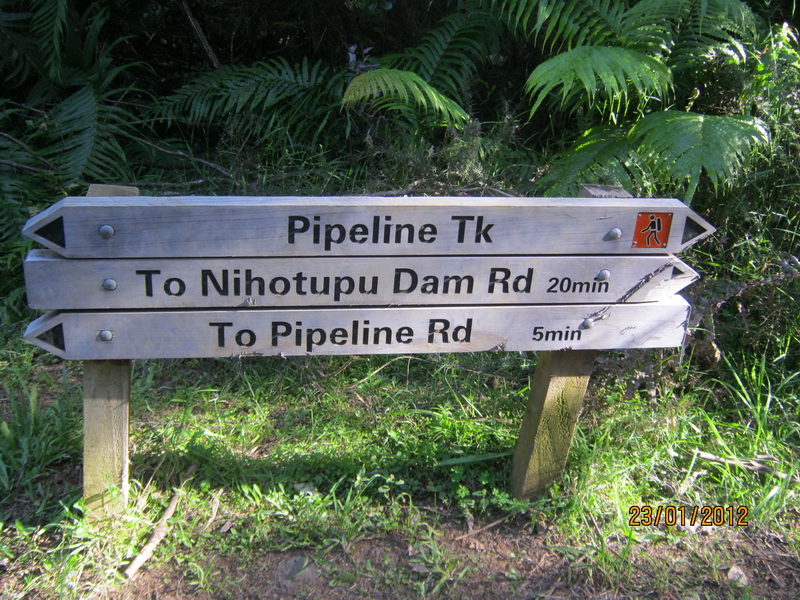
Edmond Hillary was the first man who reached Mount Everest. He is a New Zealander. This trail is named after him, but we are sure it is not the trail he used to train. We went on Monday, but we didn't go on the whole way. We went 2.5 km.
Hillary Trail
The Hillary Trail connects a network of existing regional park tracks and basic backpacker campgrounds. It takes trampers through the Waitakere Ranges, past the Arataki Visitor Centre, Huia, Whatipu, Karekare, Piha, Anawhata, and either winding north to Muriwai via the Department of Conservation's Te Henga Walkway, or through Cascade Kauri Park and onto Swanson. Trampers can also choose a public transport option, beginning their journey at Titirangi and connecting with the train at Swanson.
The Trail epitomises the sense of adventure and personal achievement that Ed Hillary himself championed and was renowned for. It is not a walk in the park - but a chance for well-prepared trampers to experience the diverse, and often challenging west coast. The ARC hopes that creating an opportunity like this, in close proximity to urban Auckland, will inspire Aucklanders to get outdoors and experience the wilderness that exists on their own doorstep.
Hillary Trail facts
The trail takes trampers through the Waitakere Ranges
Is approximately 70km
Based on four days, three nights
Back country campground stays
For experienced trampers and those with a high level of fitness
The trail was officially opened on 11 January 2010
Is bookable by phoning 09 366 2000 or visiting the Arataki Visitor Centre

http://ourworldtuesdaymeme.blogspot.com/

7 comments:
It looks like it might get easy to be lost from the signs, are people lost on it?
Ah...this might be just to difficult for me ol' bones...but hubby can do it...hhahahahah.lovely to see those pics though
Do you often go?
Ah...this might be just to difficult for me ol' bones...but hubby can do it...hhahahahah.lovely to see those pics though
Do you often go?
Sounds like a nice place for hiking. Hopefully you will not get lost on the trails.
yes, we have people getting lost in our bush, usually tourist. Our weather changes a lot. It may be very hot during the day, at night, it the thick bush, people can die of hypothermia.
In December, when there was the sudden flood, a pair of Swiss young men, went over to look at the river, next thing, they clung on a tree for their lives.
That was why, my husband back tracked to the information centre to get the map when we saw the sign.
Nice post. I learn something today. Thank you for sharing.
It looks like a wonderful hiking opportunity
Post a Comment